
Watch a recording of the September 24 virtual public information session
Rockland Riverway Trail
About the
Project
The Rockland Riverway Trail project will transform and enhance the existing major roadways, pedestrian, and non-motorized trails along the eastern side Rockland County into a shared-use pedestrian and cycling network. This proposal does not include construction of any new trails or roadways. The Trail will cross through 10 different municipalities in the County and runs a total of approximately 21 linear miles.
The Rockland Riverway Trail will:
Support the health and quality of life for Rockland County residents by maximizing access to recreation, the outdoors, and active transportation.
Explore opportunities to enhance connectivity between Rockland County communities and the surrounding counties within the Hudson Valley.
Become an engine for the County’s economic development and tourism.
Enhance the public realm by highlighting stories of local history and culture, as well as environmental sustainability.
Where the Trail follows existing roadways, the project intends to improve safety and efficiency for both motorized and non-motorized transportation to better accommodate non-motorized users. It also includes auxiliary facilities to avoid impacts and to address existing issues from stormwater runoff. The project is broken down into a series of 11 segments, which will be constructed in 11 phases over an estimated 10-year time frame, depending on the availability of funding.
As the design is developed, Rockland County will connect with key stakeholders and local communities to share updates and collect feedback. Rockland County will connect with key stakeholders and local communities along to share updates and collect feedback as the design develops.


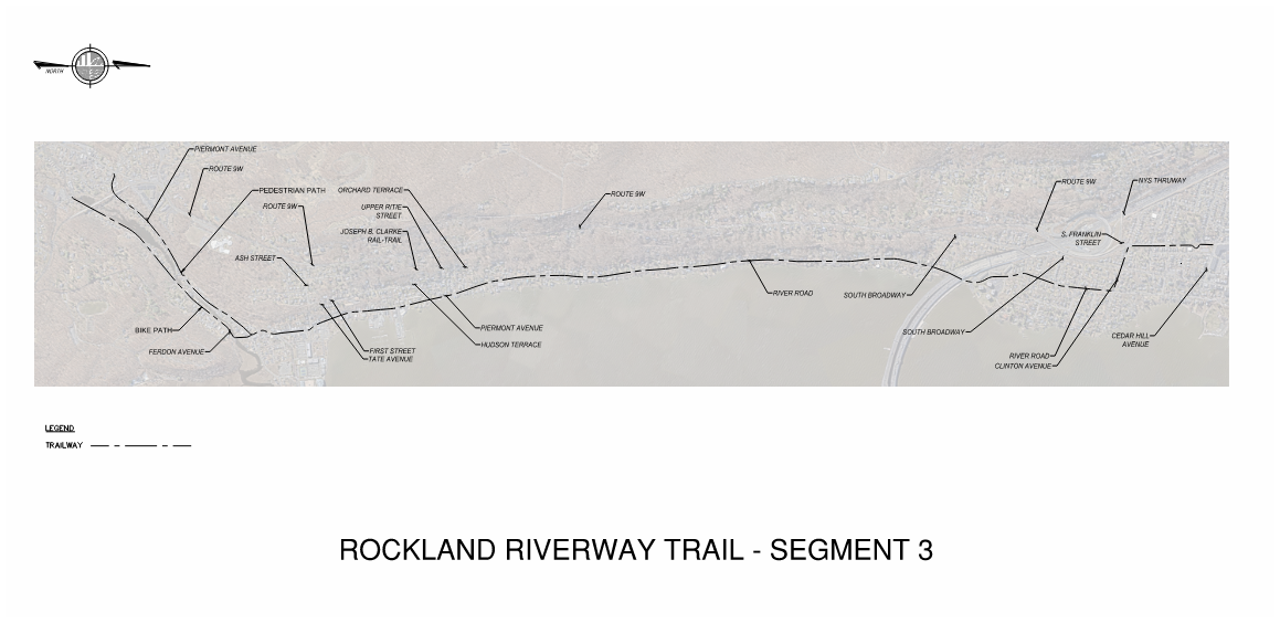


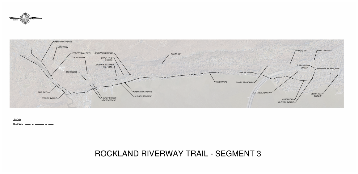


What is the Rockland Riverway Trail?
The Rockland Riverway Trail will span over 21 miles throughout Rockland County. Beginning in Palisades, NY, and terminating in Stony Point, NY, the trail will run adjacent to the Hudson River and will cross through the following municipalities and villages: Orangetown, Sparkill, Piermont, Grand-View-on-Hudson, South Nyack, Nyack, Upper Nyack, Clarkstown, Haverstraw (Village), Haverstraw (Town), West Haverstraw, Tomkins Cove, Jones Point, and Iona Island.
Survey
THANK YOU!
Thank you to the 700+ community members who shared their input on what they would like to see in signage and features along the Rockland Riverway Trail. Our survey is now closed—the Rockland Riverway Team is carefully reviewing and considering your feedback.
Get Involved
Thursday, September 24, 2026 | 5:30 PM
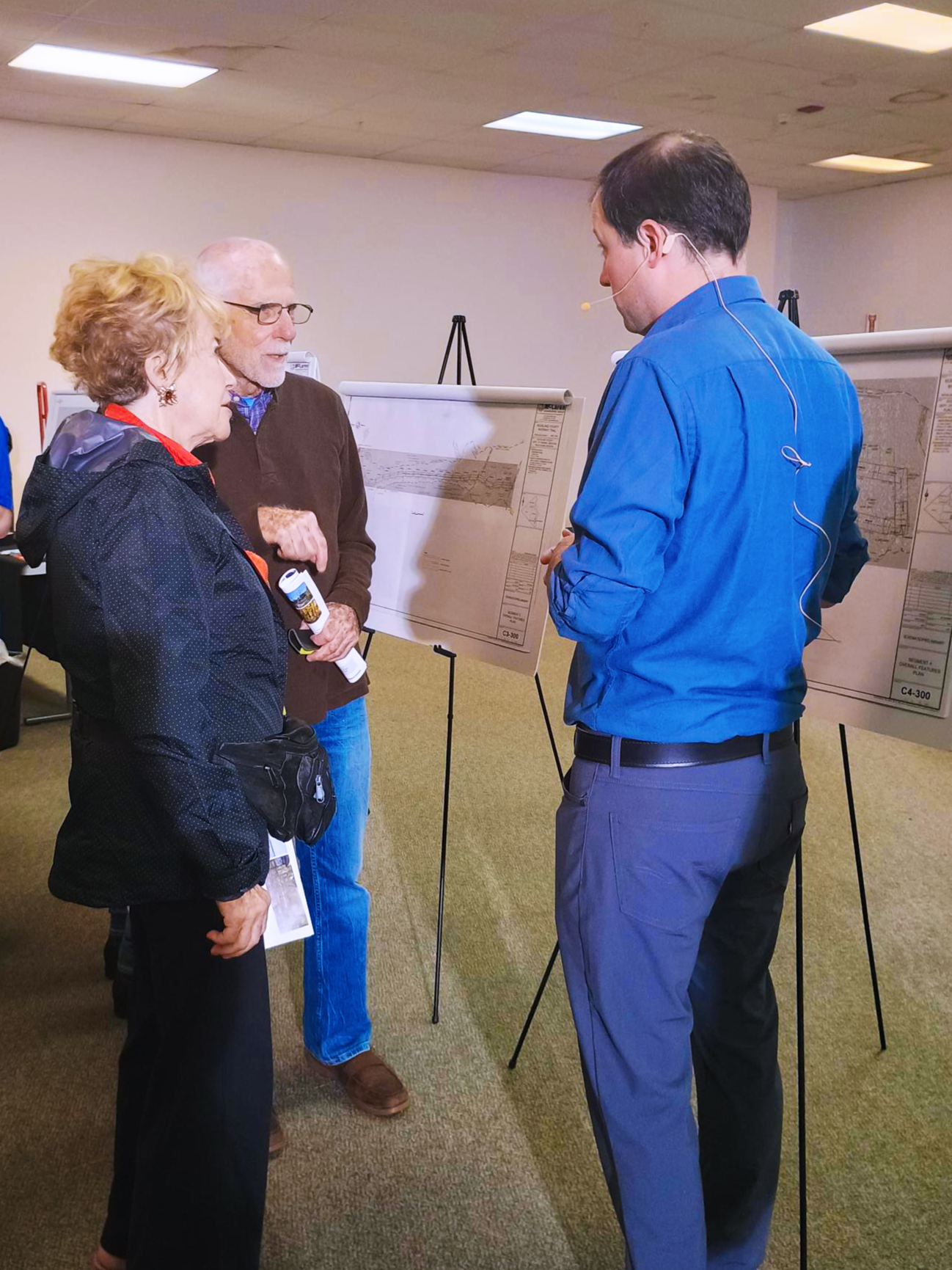
Rockland County hosted a virtual public information session to share updates on the Rockland Riverway Trail’s Final Design as the Design Phase of this project nears completion.
During the meeting, attendees:
Heard how the project team has refined the Final Design of the trail
Asked questions about the project
Learned about next steps in the project


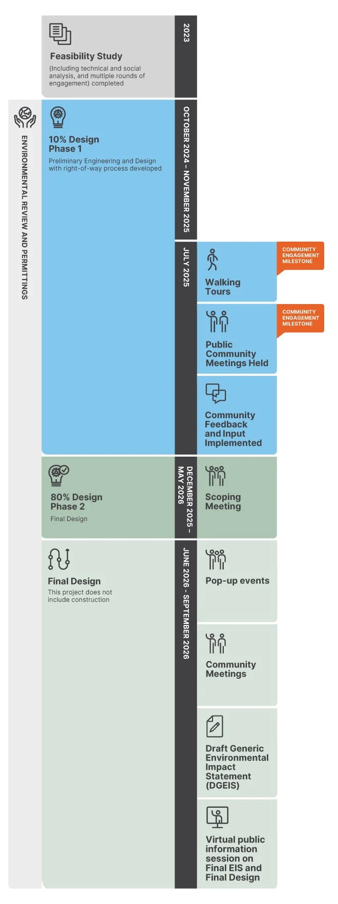
Study Timeline
Sign Up for
Updates
Stay informed with progress updates about the Rockland Riverway Trail design, future community engagement events, and information about the Trail! Complete this form to sign up for e-mail updates.
Contact
For questions or feedback on the Rockland Riverway Trail or the project, please contact rocklandriverwayevents@gmail.com.